Back to Network





3
Shared Docs
3
Same-Page
8 / 3
Mentions
Document Mentions (3 shared documents)
5 mentions1 same-page
Page ?Same page
during the late Pliocene or early Pleistocene. It is oriented generally northeast to southwest, separating St. Croix from Puerto Rico and the other Virgin Islands. Based on shallow focus earthquakes, the Anegada Fault Trough is estimated to be more than 400 miles in length. There are indications that strike sl
elineation hazardous materials and petroleum products. Bioimpact, Inc. has conducted environmental studies in the U.S. Virgin Islands, Puerto Rico, British Virgin Islands, throughout the Caribbean and in the Florida Keys. PARTIAL JOB LIST UP-DATED July 1, 2017 MONITORING PROGRAMS 2014-2017 Development and Implement
ell as boundary and topographic surveys, balloon tests, and zoning and title research, for projects throughout the southeastern US, Puerto Rico and the US Virgin Islands. :• 1993-1995, 2002-2006: Instructor, Wake Technical Community College, Raleigh, North Carolina: Conducted full semester classes in the Civil Engin
ion of sandy beach, cobble beach and shear rocky cliffs. There are 6 salt ponds on the island. SOILS OF THE PROJECT SITE The Custom Soil Survey of the Unites State Virgin Islands has classified 6 soil types on the islands of Great St. James. Cinnamon Bay gravelly loam (CgC), 5 to 12 percent slopes, occasionally flooded is us
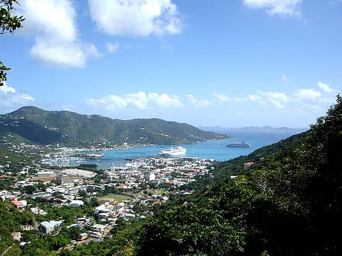
Figure 5.01.1). The Vessup Bay/Red Hook APC is located on the eastern end of St. Thomas and includes Nazareth, Muller, Vessup, Red Hook, Great Bay, Cowpet Bay, Cabrita, Beck and Water Point, Great St. James, Little St, J, and Dog Island. Areas of Particular Concern in the STEER on St. Thomas • AfO•ntrc
4 mentions1 same-page
Page ?Same page
during the late Pliocene or early Pleistocene. It is oriented generally northeast to southwest, separating St. Croix from Puerto Rico and the other Virgin Islands. Based on shallow focus earthquakes, the Anegada Fault Trough is estimated to be more than 400 miles in length. There are indications that strike sl
elineation hazardous materials and petroleum products. Bioimpact, Inc. has conducted environmental studies in the U.S. Virgin Islands, Puerto Rico, British Virgin Islands. throughout the Caribbean and in the Florida Keys. MOIMPACT, INC. Page 2 EFTA00802685 PARTIAL JOB LIST UP-DATED November 22, 2016 MONITORING P
ion of sandy beach, cobble beach and shear rocky cliffs. There are 6 salt ponds on the island. SOILS OF THE PROJECT SITE The Custom Soil Survey of the Unites State Virgin Islands has classified 6 soil types on the islands of Great St. James. Cinnamon Bay gravelly loam (CgC), 5 to 12 percent slopes, occasionally flooded is us
Figure 5.01.1). The Vessup Bay/Red Hook APC is located on the eastern end of St. Thomas and includes Nazareth, Muller, Vessup, Red Hook, Great Bay, Cowpet Bay, Cabrita, Beck and Water Point, Great St. James, Little St, J, and Dog Island. Figure 5.01.1 Areas of Particular Conem (STEER (2011) St. Thomas Eas
2 mentions1 same-page
Page ?Same page
irgin Islands hove no rivers, streams or lakes. The islands are of volcanic origin and hove mainly a hilly topography Population The population of the US Virgin Islands had increased 7% from 1990 to 2000, the most current data available, from 101,809 habitants in year 1990 to 108,612 habitants in year 2000. The shar
the subject. As mentioned, the Red Hook area houses one of the ferries used for inter-island transportation to and from St. Johns and Tortola, BVI. Cowpet Bay, just south of Red Hook is on upscale residential area featuring water views and frontage. In general, the growth patterns of St. Thomas are tied to
Sponsored
Mutual Connections (350)
Entities connected to both U.S. Virgin Islands and Cowpet Bay
Jeffrey Epstein
PERSON1,639 w/ U.S.·2 w/ Cowpet
George W. Bush
PERSON238 w/ U.S.·3 w/ Cowpet
Puerto Rico
LOCATION172 w/ U.S.·3 w/ Cowpet
St. Croix
LOCATION161 w/ U.S.·3 w/ Cowpet
MF
Maria Farmer
PERSON101 w/ U.S.·2 w/ Cowpet
Samantha Power
PERSON89 w/ U.S.·3 w/ Cowpet
Charlotte Amalie
LOCATION79 w/ U.S.·3 w/ Cowpet
William Barr
PERSON47 w/ U.S.·2 w/ Cowpet
North Carolina
LOCATION46 w/ U.S.·2 w/ Cowpet
St. John
LOCATION45 w/ U.S.·3 w/ Cowpet
Red Hook
LOCATION43 w/ U.S.·3 w/ Cowpet
Tortola
LOCATION42 w/ U.S.·3 w/ Cowpet
Anguilla
LOCATION41 w/ U.S.·2 w/ Cowpet
Larry Summers
PERSON37 w/ U.S.·2 w/ Cowpet
Jacksonville
LOCATION36 w/ U.S.·2 w/ Cowpet
Bahamas
LOCATION34 w/ U.S.·2 w/ Cowpet
North
LOCATION32 w/ U.S.·2 w/ Cowpet
Great St. James
ORGANIZATION31 w/ U.S.·2 w/ Cowpet
Bermuda
LOCATION26 w/ U.S.·2 w/ Cowpet
Christiansted
ORGANIZATION23 w/ U.S.·2 w/ Cowpet