Back to Network



3
Shared Docs
3
Same-Page
6 / 3
Mentions
Document Mentions (3 shared documents)
3 mentions1 same-page
Page ?Same page
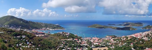
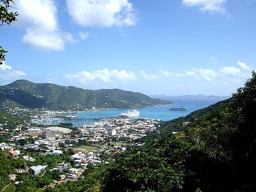
the Fortuna Community in the east with the airport in the southwest and with the town of Nadir in the eastern section of the island passing through Charlotte Amalie. Other major roods are 32, 33, 35, 38 and 40. The Cyril E. King Airport lies at the southwest section of the island and its main carrier is America
nal activities have historically taken place around its traditional core towns. There are numerous standalone retail and office buildings within the Charlotte Amalie core urban center and along the principal roads and avenues. The Havensight commercial area and shops along the boulevards and alleys of the Charlo
the subject. As mentioned, the Red Hook area houses one of the ferries used for inter-island transportation to and from St. Johns and Tortola, BVI. Cowpet Bay, just south of Red Hook is on upscale residential area featuring water views and frontage. In general, the growth patterns of St. Thomas are tied to
3 mentions1 same-page
Page ?Same page
up to 1.3ft (IRF 1977). There are no notable locally driven tidal currents due to the lack of confinement within the area. NOAA has a tide gauge in Charlotte Amalie which is a southern exposure which has been recording water levels since 1975. The high tide recorded on September 18, 1989 (Hurricane Hugo) was +3
ording water levels since 1975. The high tide recorded on September 18, 1989 (Hurricane Hugo) was +3.35ft, and in 1995 during Hurricane Marilyn the Charlotte Amalie tide station recorded the highest tide height 3.98ft above Mean Lower Low Water (MLLW). The lowest tide recorded was on February 6, 1985 and was -1
Figure 5.01.1). The Vessup Bay/Red Hook APC is located on the eastern end of St. Thomas and includes Nazareth, Muller, Vessup, Red Hook, Great Bay, Cowpet Bay, Cabrita, Beck and Water Point, Great St. James, Little St, J, and Dog Island. Figure 5.01.1 Areas of Particular Conem (STEER (2011) St. Thomas Eas
3 mentions1 same-page
Page ?Same page
up to 1.3ft (IRF 1977). There are no notable locally driven tidal currents due to the lack of confinement within the area. NOAA has a tide gauge in Charlotte Amalie which is a southern exposure which has been recording water levels since 1975. The high tide recorded on September 18, 1989 (Hurricane Hugo) was +3
ording water levels since 1975. The high tide recorded on September 18, 1989 (Hurricane Hugo) was +3.35ft, and in 1995 during Hurricane Marilyn the Charlotte Amalie tide station recorded the highest tide height 3.98ft above Mean Lower Low Water (MLLW). The lowest tide recorded was on February 6, 1985 and was -1
Figure 5.01.1). The Vessup Bay/Red Hook APC is located on the eastern end of St. Thomas and includes Nazareth, Muller, Vessup, Red Hook, Great Bay, Cowpet Bay, Cabrita, Beck and Water Point, Great St. James, Little St, J, and Dog Island. Areas of Particular Concern in the STEER on St. Thomas • AfO•ntrc
Sponsored
Mutual Connections (350)
Entities connected to both Charlotte Amalie and Cowpet Bay
Jeffrey Epstein
PERSON876 w/ Charlotte·2 w/ Cowpet
George W. Bush
PERSON483 w/ Charlotte·3 w/ Cowpet
U.S. Virgin Islands
LOCATION79 w/ Charlotte·3 w/ Cowpet
MF
Maria Farmer
PERSON42 w/ Charlotte·2 w/ Cowpet
Puerto Rico
LOCATION32 w/ Charlotte·3 w/ Cowpet
Charlotte
LOCATION30 w/ Charlotte·3 w/ Cowpet
AM
Amalie
PERSON28 w/ Charlotte·3 w/ Cowpet
Red Hook
LOCATION21 w/ Charlotte·3 w/ Cowpet
Christiansted
ORGANIZATION16 w/ Charlotte·2 w/ Cowpet
St. John
LOCATION13 w/ Charlotte·3 w/ Cowpet
St. Croix
LOCATION13 w/ Charlotte·3 w/ Cowpet
Virgin Gorda
LOCATION11 w/ Charlotte·3 w/ Cowpet
Virgin Islands Corporation
ORGANIZATION10 w/ Charlotte·2 w/ Cowpet
Tortola
LOCATION9 w/ Charlotte·3 w/ Cowpet
Saint Thomas
LOCATION10 w/ Charlotte·2 w/ Cowpet
Samantha Power
PERSON9 w/ Charlotte·3 w/ Cowpet
Water Island
LOCATION8 w/ Charlotte·2 w/ Cowpet
Crown Bay Marina
LOCATION6 w/ Charlotte·3 w/ Cowpet
Smith Bay
LOCATION6 w/ Charlotte·2 w/ Cowpet
Bahamas
LOCATION6 w/ Charlotte·2 w/ Cowpet