Back to Network




4
Shared Docs
3
Same-Page
5 / 4
Mentions
Document Mentions (4 shared documents)
3 mentions1 same-page
Page ?Same page
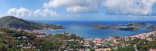
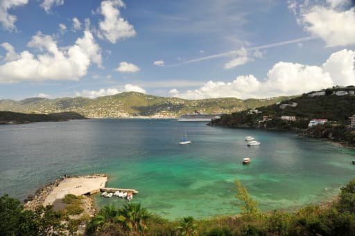
merican Yacht Harbor Marina EFTA00803886 Surrounding Area Analysis 22 Surrounding Area Analysis Location The subject is located in the town of Red Hook in the East End area of the Island known as Estate Smith Bay. Red Hook is one of the three primary business districts on the island. Access and Lin
mand in this area over the past 12-24 months as shown by the low vacancy in the 3 major retail properties Red Hook; American Yacht Harbor (subject), Red Hook Plaza and Galleria Shopping Center. Compared to the territory area as a whole, the local area has higher income levels. Population trends are simi
uz Bay is located on the western coast of the island and serves as its primary port and link to St Thomas. Nearly two thirds of St John is owned by the National Park Service and is off-limits to commercial development. St Croix is largest of the three islands, in both land area and population. It is roughly 45 miles to t
2 mentions1 same-page
Page ?Same page
icular Concern (APC) (Figure 5.01.1). The Vessup Bay/Red Hook APC is located on the eastern end of St. Thomas and includes Nazareth, Muller, Vessup, Red Hook, Great Bay, Cowpet Bay, Cabrita, Beck and Water Point, Great St. James, Little St, J, and Dog Island. Figure 5.01.1 Areas of Particular Conem (STE
ty prepared for Danested, St. Croix Salt River Environmental Impact Statement for the proposed National Park at Salt River, St. Croix, prepared for the National Park Service V.I. Water and Power Authority Environmental Assessment Report for the Construction of a desalination unit on St. John, prepared for the V.I. Water
2 mentions1 same-page
Page ?Same page
icular Concern (APC) (Figure 5.01.1). The Vessup Bay/Red Hook APC is located on the eastern end of St. Thomas and includes Nazareth, Muller, Vessup, Red Hook, Great Bay, Cowpet Bay, Cabrita, Beck and Water Point, Great St. James, Little St, J, and Dog Island. Areas of Particular Concern in the STEER on
ty prepared for Danested, St. Croix Salt River Environmental Impact Statement for the proposed National Park at Salt River, St. Croix, prepared for the National Park Service V.I. Water and Power Authority Environmental Assessment Report for the Construction of a desalination unit on St. John, prepared for the V.I. Water
Sponsored
Page HOUSE_OVERSIGHT_018819
Cruz Bay is located on the western coast of the island and serves as its primary port and link to St Thomas. Nearly two thirds of St John is owned by the National Park Service and is off-limits to commercial development. St Croix is largest of the three islands, in both land area and population. It is roughly 45 miles to t
Page: HOUSE_OVERSIGHT_018819 →Page HOUSE_OVERSIGHT_018832
HOUSE_OVERSIGHT_018831 --- PAGE BREAK --- Surrounding Area Analysis 22 Surrounding Area Analysis Location The subject is located in the town of Red Hook in the East End area of the Island known as Estate Smith Bay. Red Hook is one of the three primary business districts on the island. Access and Link
Page: HOUSE_OVERSIGHT_018832 →Sponsored
Mutual Connections (422)
Entities connected to both Red Hook and the National Park Service
Jeffrey Epstein
PERSON201 w/ Red·11 w/ the
U.S. Virgin Islands
LOCATION43 w/ Red·5 w/ the
Marc Rich
PERSON40 w/ Red·4 w/ the
St Thomas
LOCATION29 w/ Red·2 w/ the
George W. Bush
PERSON25 w/ Red·3 w/ the
Charlotte Amalie
LOCATION21 w/ Red·5 w/ the
Puerto Rico
LOCATION15 w/ Red·5 w/ the
Tortola
LOCATION15 w/ Red·4 w/ the
St. John
LOCATION13 w/ Red·5 w/ the
United States
LOCATION14 w/ Red·4 w/ the
St. Croix
LOCATION11 w/ Red·4 w/ the
Great St. James
ORGANIZATION13 w/ Red·2 w/ the
Water Island
LOCATION9 w/ Red·5 w/ the
San Juan
LOCATION9 w/ Red·4 w/ the
Prince Andrew
PERSON9 w/ Red·4 w/ the
Samantha Power
PERSON10 w/ Red·3 w/ the
DB
Doug Band
PERSON10 w/ Red·3 w/ the
MF
Maria Farmer
PERSON8 w/ Red·4 w/ the
Eric Trump
PERSON3 w/ Red·9 w/ the
Virgin Gorda
LOCATION7 w/ Red·4 w/ the